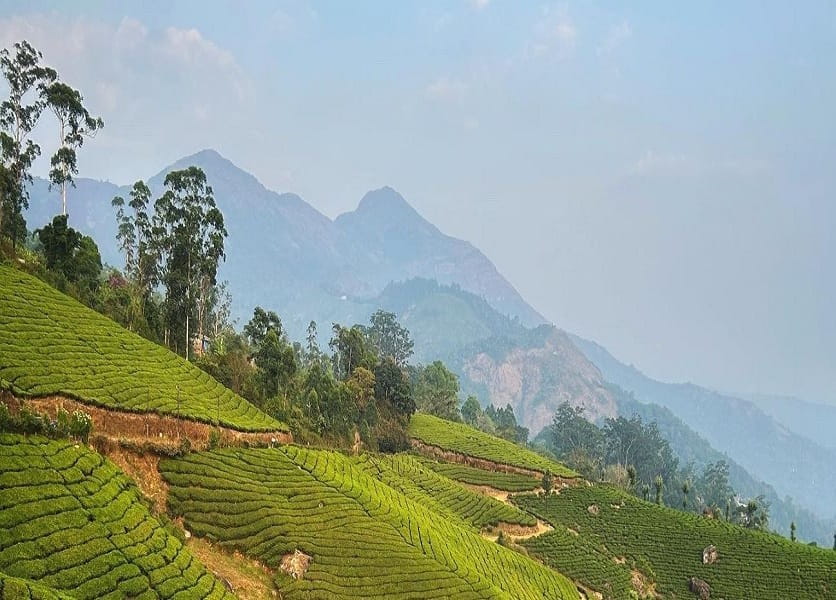
I’ve lived in the Idukki district almost 6 months. I know which tea estate roads get waterlogged in June. I know the shopkeeper near Rajamala who gives you free ginger tea if you’ve hiked up and look like you might pass out. And I know — probably better than anyone — that the waterfalls tourists visit in Munnar are only about 10% of what this hill station is actually hiding.
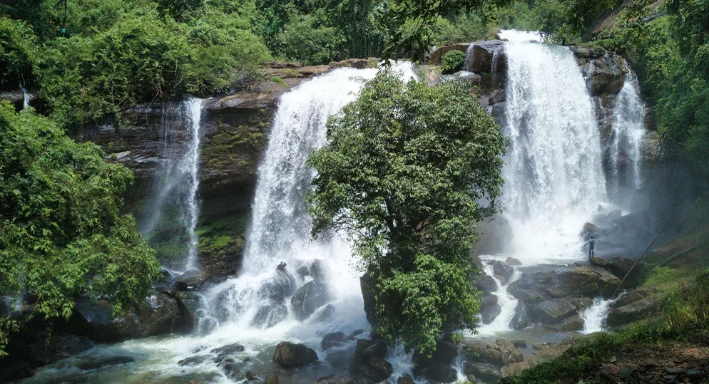
The famous ones — Attukal, Lakkam, Cheeyappara — yes, they’re beautiful. But they’re also crowded, fenced-off, and commercialized to the point where you’re basically standing in a queue to look at water. The real Munnar, the Munnar that hasn’t been photographed to death, is still out there. It’s up broken jeep roads, past cardamom plantations that smell like heaven, behind tea-estate gates that look locked but aren’t.
These seven waterfalls took me years to collect. Some I found by accident — on walks I wasn’t supposed to be on. Some a plantation worker mentioned over chai. One I found because a monsoon landslide opened a path that didn’t exist before. None of them are secret forever, but for now, they’re quiet. Let’s try to keep it that way.
Best Season: Oct – Feb
Avoid: June – Aug
Nearest City: Munnar Town
Difficulty: Varies
Entry Fee: ₹0 – ₹50
The Seven Falls
In no particular order — each one earns its place on this list for a different reason.
Kolukkumalai Falls
The One Above the Clouds · ~2,100m Elevation
Kolukkumalai Ridge, Munnar High Altitude
📍34 km from Munnar Town
Moderate Trek
🌡️8–14°C in Winter
🕐Best: 6 – 9 AM
Most people who visit Kolukkumalai go for the tea factory — the world’s highest organic tea estate, a label that’s marketed aggressively and rightly so. But they get there, drink the tea, take the selfie, and leave. Almost none of them walk the extra forty minutes northeast of the factory along the ridge trail.
That’s where the falls are. There’s no name on a map. Locals call it variously “the stream behind the drying shed” or just gesture vaguely upward when you ask. It drops about 60 feet in two cascades, and because of the elevation, there’s almost always mist rolling across it, even in October when the rest of Kerala is bone dry. The water is cold enough to genuinely ache after ten seconds.
The best part? You need a jeep to reach Kolukkumalai in the first place — the road is a legendary rattling adventure that discourages casual visitors. By the time you’ve survived that and done the tea factory tour, 80% of tourists are ready to go back down. The falls belong to whoever remains.
One practical note: the trail to the falls passes through active plantation land. Don’t push through if someone asks you to stop. Most of the time, nobody will. But bring a small gift — a packet of biscuits, anything — as a courtesy if you encounter a watchman. Kerala hospitality works both ways.
Insider Intel
Hire the same jeep driver for the full day. Tell him you want to see the falls behind the factory. If he’s from the area (ask), he’ll know exactly where to point you. The ones who don’t know will pretend they do — a bad sign. The good ones will say “ah, antha vazhiyil” and nod like they’ve been waiting for someone to ask.
Mangaladevi Hidden Stream Falls
📍15 km from Munnar
🎫Forest Permit Needed
🐘Wildlife Zone
📅Open: April–May only
The Mangaladevi temple sits right on the Kerala-Tamil Nadu border, and the forest around it is so protected that tourists can only visit during the Chittirai festival — roughly mid-April to early May. Most people make the trip, visit the temple, and turn back. This is exactly the wrong move.
About 1.2 kilometers north of the temple, following the stream that runs parallel to the forest road, you’ll find what I call the Mangaladevi Hidden Stream Falls — though that’s my name for it, not an official one. It’s a 40-foot drop into a pool that’s obscured by a canopy so dense that at noon you’d swear it was dusk. The water is tannin-stained to a light amber from the leaf matter upstream — safe to touch, spectacular to photograph.
The catch: you need a forest permit, a registered guide, and you must be out of the area before 5 PM. This isn’t bureaucratic nonsense — there are genuinely wild elephants in this forest. The Forest Department checkpoint is serious about these rules. Go through proper channels. The District Forest Officer office in Munnar Town handles permits and it costs next to nothing — ₹30–₹60 per person the last time I checked.
The window of access is small — those few weeks in April and May — but if your travel dates align, this is the most ecologically raw waterfall on this list. Nothing has been touched. Nothing has been built. It’s just the forest doing its thing, water doing its thing, and you, quietly watching.
Wildlife Alert: This area has elephant corridors. Do not visit without an assigned forest guide, stay on the designated path, and make moderate noise as you walk. Do not visit during or after heavy rain — the stream levels become dangerous within hours, and elephant movement near water sources increases significantly.
Chinnakanal Village Falls
The One Hiding in Plain Sight · 3 km from NH 85
Chinnakanal Village, near Power House JunctionEasy Access
📍20 km from Munnar Town
🚗Road Access to Base
🥾Easy Walk: 15 min
✅Year-Round
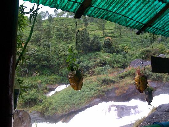
This one genuinely baffles me in terms of why it hasn’t been discovered yet. The Chinnakanal area is popular — it sits on the road toward Munnar from the Kochi direction, and thousands of cars drive through every weekend. But nearly all of them stop at Cheiyappara or Valara, the two big commercial falls on the highway, and never go the extra 3 kilometers toward the village itself.
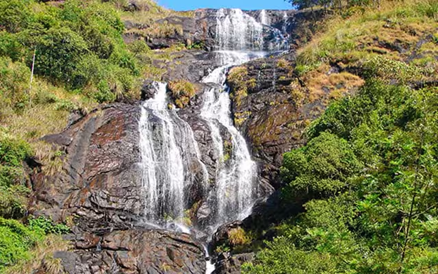
Down a mud road off the main Chinnakanal road, past a small cluster of houses and a tiny Vinayaka shrine with marigolds always fresh on it, a stream drops about 80 feet in a single uninterrupted curtain before spreading into a flat, rocky basin. The basin is natural swimming territory — maybe 3 feet deep, cold but not brutal, with enough flat rocks around it to set down a bag and just sit.
I’ve been here on a random Tuesday in November and had the whole place to myself for two hours. I’ve also been here on a Saturday in January and met four people — two of them locals who live in the village. The kind of place where you end up talking to strangers and someone usually offers you something they brought for lunch.
The “why don’t tourists find it” answer is simple: there’s no sign, and the mud road looks like it leads to someone’s house (it partially does). The key is to look for the concrete electricity pole with a blue mark at the road fork — that’s the turn. From there, fifteen minutes on foot through a cardamom patch and you’re there.
Insider Intel
The family in the first house by the turn sometimes does home-cooked meals on request — rice, dal, papad, and something pickle-adjacent that you will not find on any restaurant menu. Knock, ask politely, be prepared to wait 40 minutes, and eat the best ₹80 meal of your life. They don’t advertise this. Don’t push if they say no.
Pothamedu Viewpoint Stream
The Sunset Falls · Most Photographable Light in Munnar
Pothamedu, 3.5 km from Munnar Town Golden Hour
📍3.5 km from Town
🕔Best: 4 – 6 PM
🚶25 min Hike
📷Photographer’s Spot
Everyone knows Pothamedu Viewpoint — it’s on every Munnar itinerary, the panoramic sweep of tea and cardamom and coffee stretching to the horizon. But the viewpoint itself has become a selfie circus. What nobody tells you is that there’s a valley waterfall below the viewpoint, accessible by a steep unmarked path that begins about 200 meters east of the main platform.
The path drops sharply — it’s not dangerous, but wear shoes you don’t care about because the soil is perpetually moist. About 25 minutes of descent brings you to a stream fed by three separate trickles from the surrounding hills, which converge and drop about 30 feet over a mossy granite face before continuing into the valley.
What makes this specific: the afternoon light. Between 4 and 6 PM, the angle of sunlight through the western hills hits the falling water at a low angle that creates a prismatic spray effect. Photographers who’ve found this spot don’t share the location widely — I’ve met two of them here, both locals, both a little annoyed that I’d found it. We agreed not to put it on Instagram. (I’m writing about it instead, so perhaps I’ve broken that spirit. At least it won’t show up on Google Maps.)
The stream pool at the base is shallow and clear. You can sit on the granite and let the spray reach you without getting properly wet. It’s one of the more quietly magical thirty-minute windows you can have in Munnar — especially if you time it right and hit that golden-hour spray effect on a clear day.
Insider Intel
The path back up in the dark is genuinely confusing. If you’re going for the 4–6 PM light, bring a torch. The descent is also easier than it looks — the ascent is the tiring part, so budget energy for it. Carry water. The stream looks clean but don’t drink from it — the tea estates above use fertilizer that drains into these streams.
The real Munnar doesn’t wait at a viewpoint with a railing. It waits around a bend, over a stream, past a sign that says ‘Private Road’ in faded paint that nobody’s enforced in years.
— A jeep driver I met near Rajamala, whose name I forgot to ask
Anachal Tea Estate Falls
The Plantation Secret · Permission Needed, Usually Given
Anachal, 13 km from Munnar Town Estate Access
📍13 km from Munnar
🤝Ask at Estate Office
🥾Easy-Moderate
☕Tea Rows All Around
Anachal is a small town on the Munnar–Kothamangalam road, and the tea estates around it are among the oldest in the Idukki district. The Anachal Tea Estate (run by a subsidiary I won’t name, since management changes) has a small waterfall inside its boundaries — a 50-foot drop into a rocky channel that runs alongside one of the lower tea rows before disappearing into a culvert.
Here is the honest truth about getting in: you walk up to the estate office — a small building, usually with a metal gate — and you ask. You say you heard there’s a waterfall inside and you’d like to see it. About 70% of the time, the supervisor on duty will say yes, tell you not to trample the rows, and wave you through. The other 30%, he’ll say no, and that’s fine — you thank him and leave. Never try to sneak into a working plantation. People live and work there.
The waterfall itself sits in a natural break in the estate — a rocky outcrop that the tea planters couldn’t terrace, so it was left wild. Around it, the manicured rows of tea create a surreal contrast: clipped green geometry on all sides, and then this raw, dripping, moss-covered rupture of nature in the middle of it. The air smells simultaneously of wet earth and fresh tea leaf. I’ve never experienced that combination anywhere else.
Go on a weekday morning, when the estate workers are in the field and the office staff are less harried. Bring a small thank-you — tea from outside is considered slightly funny and slightly charming. They get it. They always get it.
Respect the workspace: This is an active agricultural estate, not a tourist site. Stay on paths. Do not pluck tea leaves, even as a souvenir — it’s both disrespectful and technically theft of produce. Leave no rubbish. These small courtesies determine whether the next traveler gets access or finds the gate locked for good.
Devikulam Misty Cascade
The Quiet Valley Drop · Loch Sita Nearby
Devikulam, 7 km from Munnar Town Year-Round Mist
📍7 km from Munnar
🌧️Mist Year-Round
🥾Moderate
🏖️Natural Pool
Devikulam is known for Sita Devi Lake — a calm reservoir surrounded by eucalyptus that tourists visit, photograph, and largely misunderstand. The lake is pleasant but the real geographical drama is in the valley below Devikulam, where a series of streams from the surrounding hills converge and eventually produce a cascade that most people in Munnar don’t even realize exists.
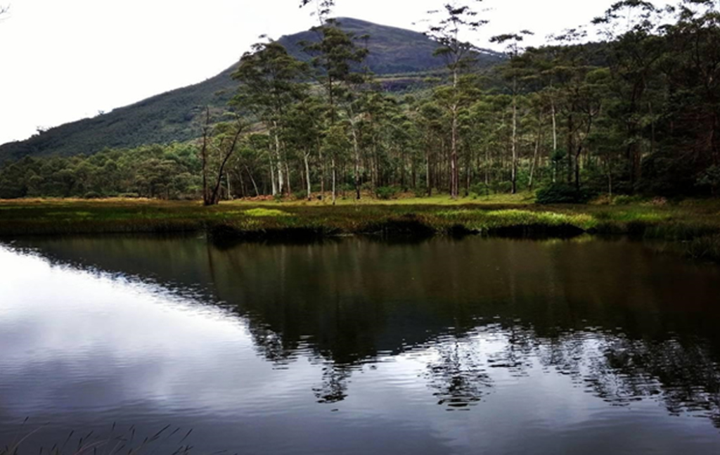
Finding it requires walking past the lake on the far side — the side away from the parking lot — and following the stream that feeds it. The path is loose and requires some careful footing on wet rocks, but nothing requiring technical skill. After roughly 35 minutes of stream-side walking, the valley narrows and the stream drops about 70 feet in a fan-shaped spread across a basalt face. The basin is large, pool-like, and surrounded by ferns so thick they look architectural.
What is remarkable about this specific location is its persistent mist. Even in January — Munnar’s driest month — there is almost always a haze around this falls. The combination of elevation, surrounding canopy, and the sheer volume of water creates its own microclimate. Photographs taken here look processed, over-saturated — except they’re not. That’s just the light through the spray.
I’ve brought three different photographers here over the years. All three said it was the most technically interesting waterfall they’d shot in Kerala — specifically because the mist creates natural diffusion that you’d normally need a filter to achieve. If photography is part of why you travel, add this to your priority list.
Insider Intel
The rocks near the basin are permanently wet and covered in algae. Old rubber chappals will betray you here — the soles provide zero grip on wet basalt. Wear trekking shoes or proper rubber-soled footwear. The rocks look gentle and flat but are genuinely slippery. I’ve seen two people go down here in one afternoon; neither was seriously hurt but both were mortified. Don’t be them.
Eravikulam Fringe Falls
The Edge of the National Park · Seasonal Access
Eravikulam NP Buffer Zone, near Rajamala National Park Edge
📍13 km from Munnar
🦌Nilgiri Tahr Territory
📅Dec – Mar Best
🚫Stay in Buffer Zone
Eravikulam National Park — home of the Nilgiri Tahr and one of the most biodiverse high-altitude ecosystems in the Western Ghats — has a specific tourism zone around Rajamala that most visitors stick to. You walk the designated trail, see the Tahr grazing with disturbing casualness near the viewpoint, take photos, and leave. It’s genuinely wonderful. But the park has fringes.
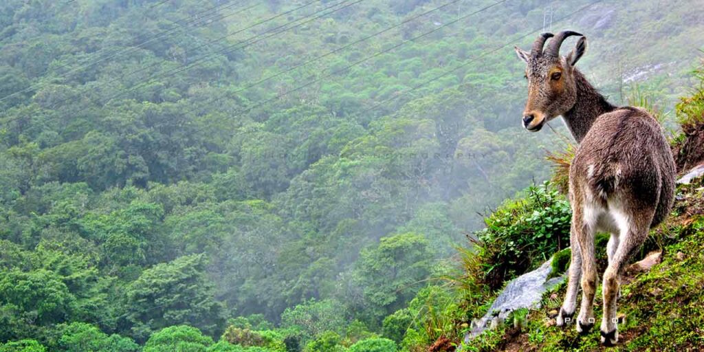
On the eastern buffer zone — which is technically accessible without entering the park itself, because it runs along the boundary where the forest meets the road — there are two small seasonal falls that form only between December and March, fed entirely by the mist-condensation off Anamudi. They’re not massive — the larger of the two drops maybe 25 feet. But the context is extraordinary: you’re standing at the edge of a high-altitude shola grassland ecosystem, Nilgiri Tahr possibly visible on the ridgeline above you, and a thin silver thread of water appearing out of what looks like solid rock because the condensation feeds directly into a hairline fissure.
This is the most ecologically specific waterfall on this list. It doesn’t exist because of rainfall — it exists because of the Western Ghats’ unique ability to generate its own weather. Mist rolls off Anamudi (South India’s highest peak, right above you), condenses on cold rock, trickles, joins, and by December you have a waterfall that was literally made by clouds deciding to be water. I find that extraordinary.
Stay strictly within the buffer zone and do not attempt to enter the park boundary without authorization. The park staff are present, and Eravikulam is a genuinely sensitive conservation area. The Tahr’s recovery from near-extinction is an ongoing effort. Don’t compromise it by pushing into restricted areas for a better view.
Insider Intel
Hire the KTDC bus to Rajamala, then walk eastward from the viewpoint along the outer road for about 800 meters. The falls are to your left, down a very short scramble on a visible path. The Nilgiri Tahr near the viewpoint are habituated to humans and oddly photogenic — don’t feed them, don’t touch them, and for reasons I still can’t explain, don’t approach them with an open umbrella. The park brochure specifically mentions this. I am not making it up.
Before You Go: The Honest Planning Guide
No fluff. Just what actually matters when planning a hidden waterfall trip in Munnar.
When to Visit
- October–February: Best overall season
- March–May: Dry but hot; Mangaladevi access
- June–August: Avoid — floods and leeches
- September: Beautiful but slippery and risky
- Weekdays always beat weekends dramatically
What to Pack
- Grip rubber-soled trekking shoes (non-negotiable)
- Dry bag or waterproof case for phone
- Insect repellent — especially October
- A light rain jacket even in winter
- Cash only; no UPI signal in these areas
- Glucose biscuits for energy and gifting
Getting Around
- Hire a local jeep, not a city cab service
- Full-day hire: ₹2,500–₹4,000
- The driver’s local knowledge is the real asset
- KSRTC buses cover main roads only
- Bike rentals work for road-accessible spots
- Confirm driver speaks some English or Hindi
Safety First
- Never swim alone in remote pools
- Check weather forecast morning of each hike
- Tell someone your rough route each day
- Carry water — never drink from streams
- Monsoon water levels change within hours
- Exit all forest areas before 5:30 PM
Leave No Trace
- Pack out every piece of rubbish, always
- Don’t pick flowers or break branches
- No fires near streams or dry vegetation
- Keep noise low in wildlife zones
- Don’t share GPS pins on public platforms
- These places stay secret by choice, not accident
Budget Reality
- Entry fees: ₹0–₹100 at most spots
- Jeep hire: biggest daily expense
- Food near villages: surprisingly cheap
- No “tourist pricing” in off-beat areas
- Always carry ₹500–₹1,000 in small change
- Gratitude tips to guides are always appropriate
Questions People Actually Ask
Are any of these accessible if I’m not a serious trekker?
Yes — Chinnakanal Village Falls and Devikulam Misty Cascade both require only a short walk on reasonably flat terrain. Chinnakanal especially can be done in regular footwear on a dry day. The Kolukkumalai Falls and Mangaladevi Falls require moderate fitness and proper shoes. Eravikulam Fringe Falls requires the least effort of the “remote” ones — it’s a road walk more than a trek.
What’s the one thing most tourists get wrong about Munnar travel?
Timing. They arrive at the popular spots between 10 AM and 2 PM — exactly when every other tourist bus arrives. The magic of Munnar is in early mornings and late afternoons. The light is better, the crowds are gone, and wildlife is actually visible. If you’re waking up at 9 AM on a Munnar trip, you’re already too late to the good stuff.
Is it safe to visit these places as a solo traveler or solo woman?
Solo travel in Munnar is generally safe, and the rural communities around these spots are not predatory or unwelcoming toward tourists. That said, the practical risks for any solo traveler — remote location, spotty mobile signal, potential for slipping or injury — are real. If you’re traveling solo, stick to the more accessible falls (Chinnakanal, Pothamedu), tell someone your plan, and carry a charged power bank. For Mangaladevi and Kolukkumalai, a guide is strongly recommended regardless of gender.
Do I need permission for all of these?
Formal permits are required only for Mangaladevi (Forest Department permit) and recommended for Eravikulam buffer zone. For the Anachal Tea Estate, informal permission from the estate office is the right approach. The others don’t require permits, but some pass through private land — reading the local situation and asking where appropriate is the rule of thumb.
What happens if I try to visit during monsoon?
Honestly? Some of the most spectacular water volumes you’ve ever seen. But also: leeches everywhere, flash flood risk on stream trails, landslides on mountain roads, and genuinely dangerous slippery rock surfaces. The Munnar monsoon is not a light drizzle — it’s serious, sustained, and the hills funnel water into streams faster than most tourists are prepared for. I’d say: don’t do remote waterfall hiking June–August. Visit in early October instead — the monsoon is ending, the water is still high, and the hills are the most intensely green they’ll ever be.
Can I camp near any of these waterfalls?
Not legally at the forest-reserve or national park adjacent ones. For the others, there’s no formal prohibition, but no formal campsite either — meaning no facilities, and you’re responsible for everything you bring in and out. A few guesthouses in Chinnakanal and Anachal offer basic stays nearby. Kolukkumalai has a famous tea estate bungalow with very limited bookings — booking it months in advance and waking up at that altitude before the mist burns off is one of the more extraordinary experiences available in south India.
Read Also this: The New Gap Road: A Photographic Guide to the Most Beautiful Road in South India
The Falls Will Still Be There. The Silence Might Not.
Every place on this list is currently quiet. Not all of them will stay that way — the moment a waterfall appears on a popular Instagram account or gets added to Google Maps, the dynamic shifts. A parking lot materializes. A chai stall follows. Then the weekend buses, the guards with whistles, the entry fee booth. It’s a well-worn sequence and it happens to every “hidden gem” eventually.
I’m not naive enough to think writing about these places doesn’t contribute to that. But I’d rather they be found by people who read 2,000 words and understand what they’re walking into — people who will ask before entering, leave nothing behind, and resist the urge to pin it publicly — than have them remain secret for no particular reason while the accessible but mediocre spots get all the footfall.
Go to Munnar. Go past the tea estates you’ve seen in photographs. Ask the jeep driver what he sees every day that nobody asks about. Carry food enough to share. Talk to people. The Western Ghats reward slowness and curiosity more consistently than any other landscape I’ve spent time in — and I’ve spent a lot of time in it.
The falls are out there. Some mornings, they’re yours entirely. That’s worth the muddy shoes.

Sunil Singh is a dedicated travel content writer and the founder of MunnarTeaGardens.in. He specializes in creating comprehensive, user-friendly guides on Munnar’s tea gardens, hill stations, and Kerala tourism. Drawing from the latest tourism trends, official sources, and visitor experiences, Sunil helps thousands of travelers plan safe and rewarding trips every year.